GIS Development
Automated Digitizing Tool Built using ESRI JS API
Streamlining GIS workflows with automated digitization tools that reduce manual effort and improve data accuracy in mapping projects.
July 20, 2021
8 min read
5.8k views120 likes
Sharing knowledge, insights, and best practices in GIS development, machine learning integration, and geospatial analysis.
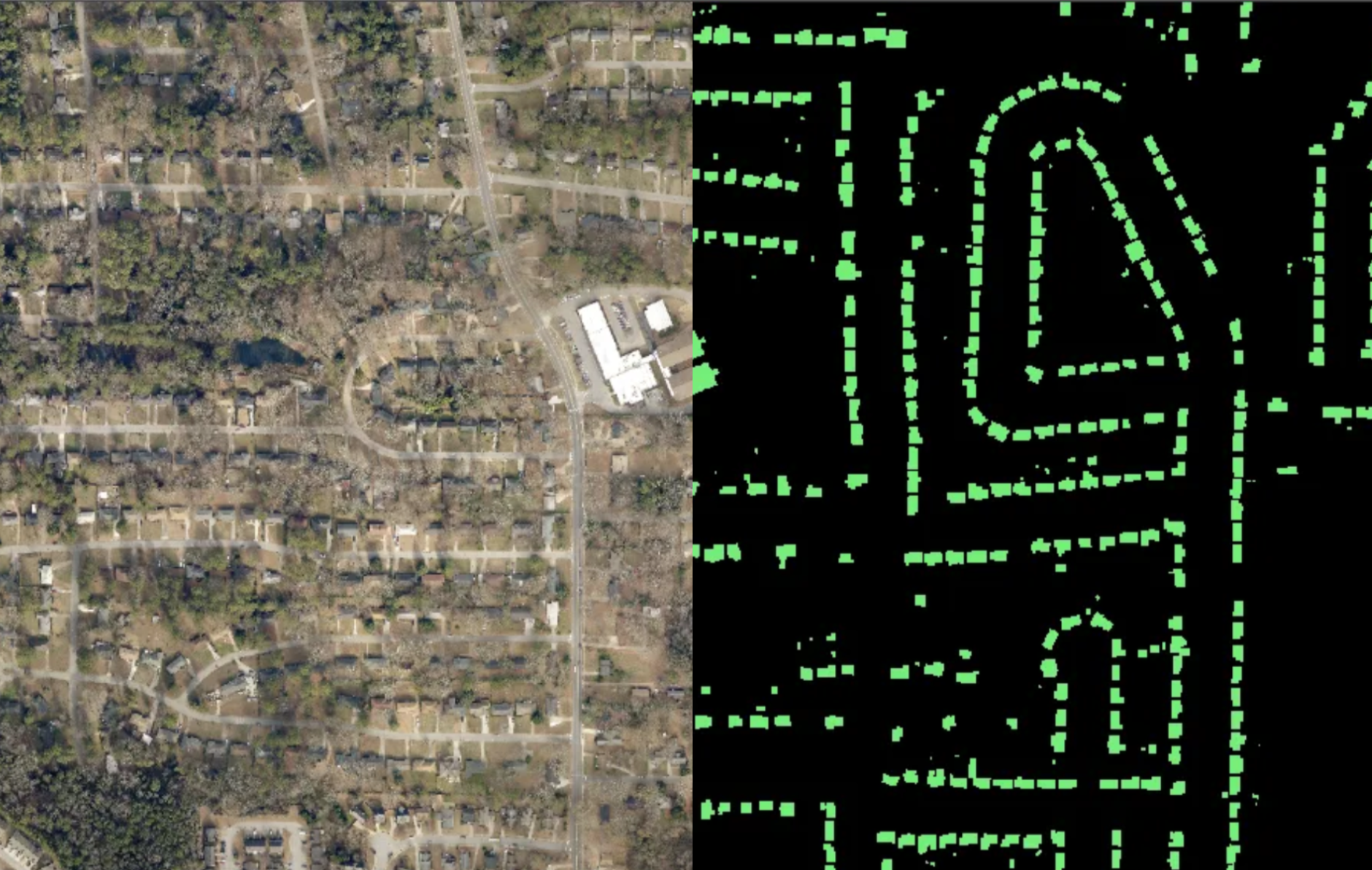
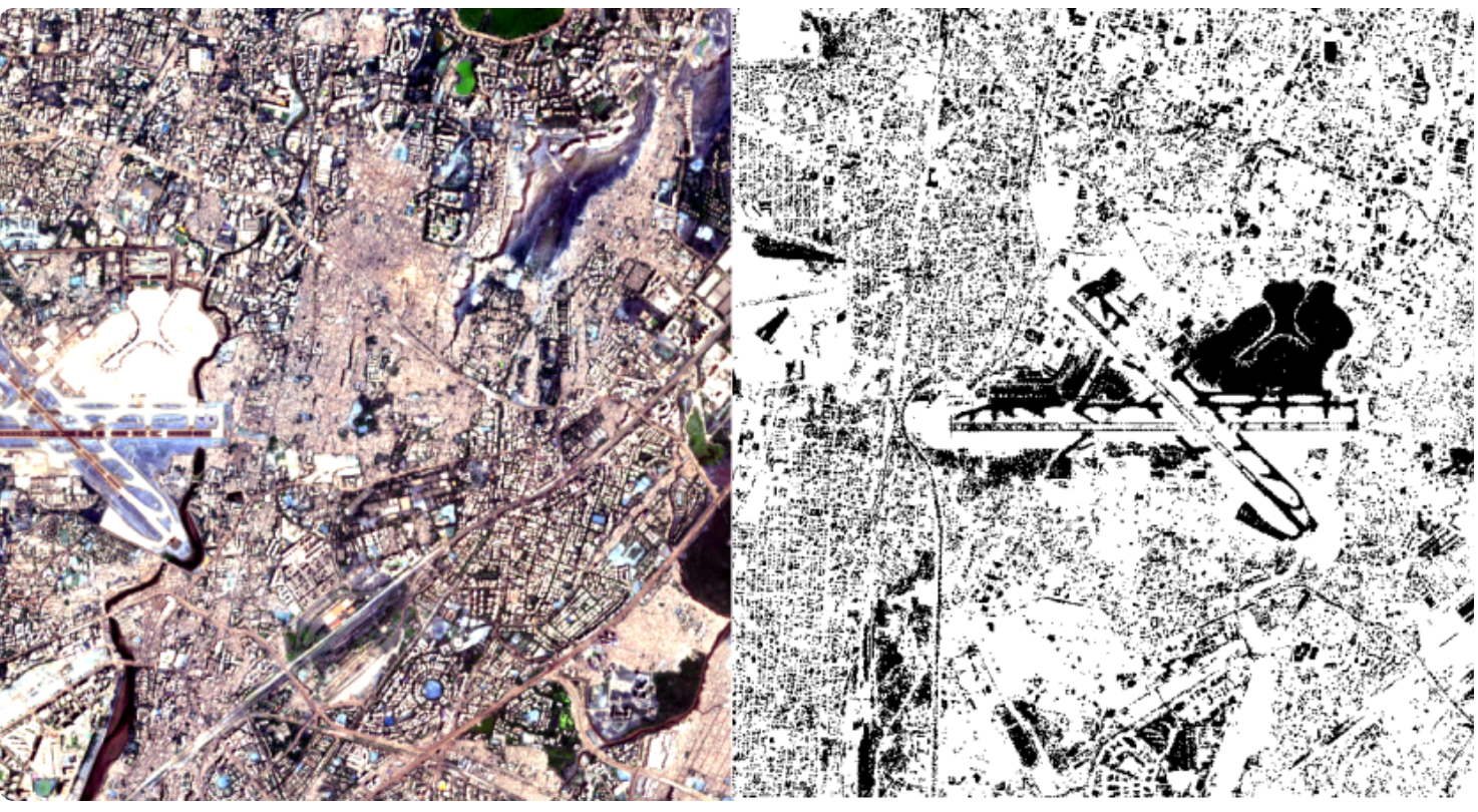
A comprehensive guide to implementing deep learning algorithms for semantic segmentation of satellite imagery, covering building footprint extraction and land cover classification.
Streamlining GIS workflows with automated digitization tools that reduce manual effort and improve data accuracy in mapping projects.
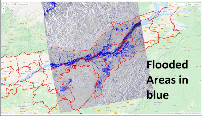
Real-time satellite analysis and flood mapping techniques for emergency response and damage assessment during natural disasters.
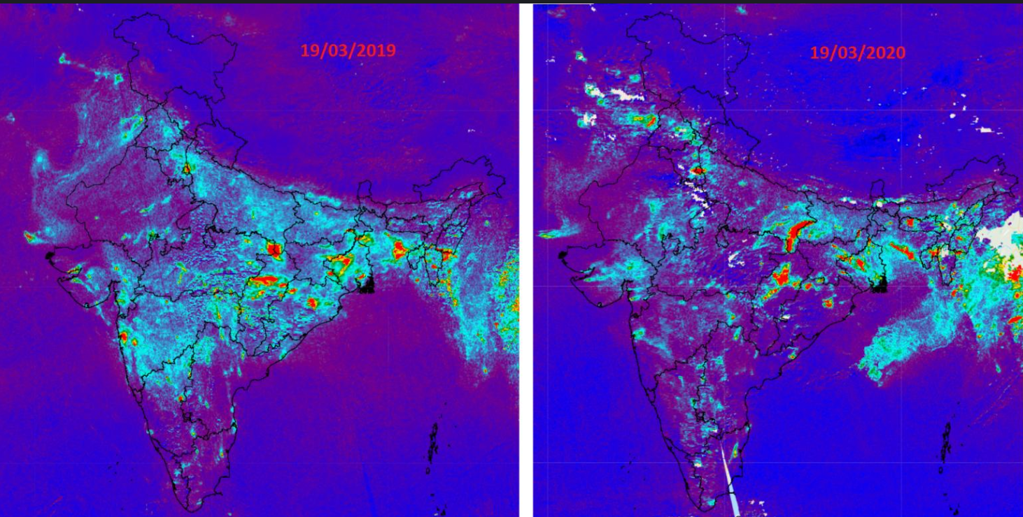
Environmental impact assessment using satellite data to analyze air quality changes during the COVID-19 pandemic lockdown periods.
Comparative analysis of traditional machine learning approaches versus deep learning methods for satellite imagery classification tasks.
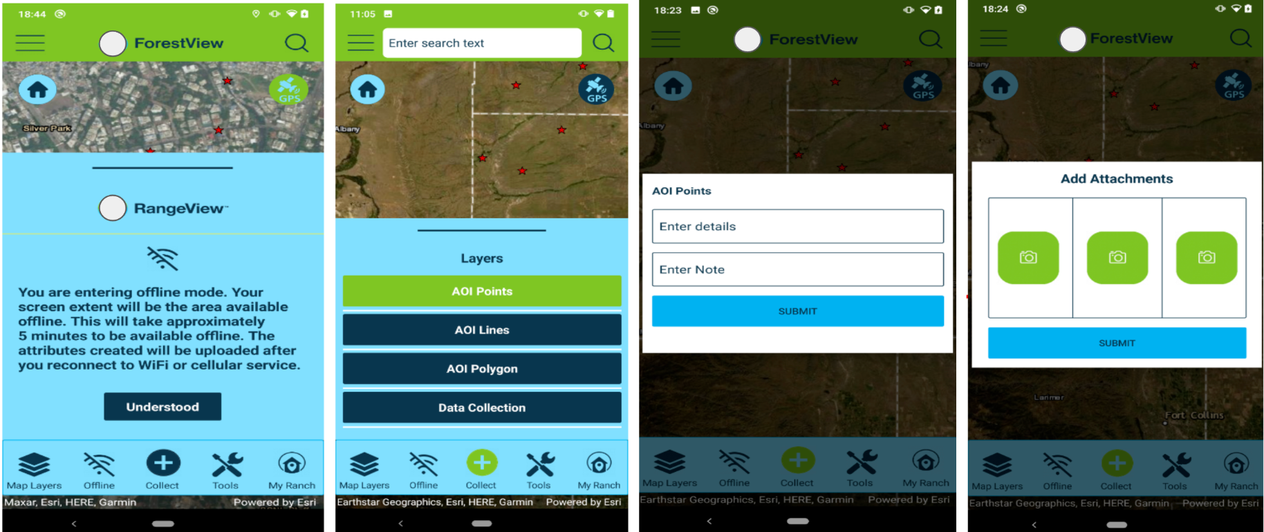
Best practices and architectural patterns for developing enterprise-grade mobile GIS applications with offline capabilities.
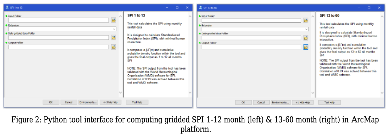
Implementation of automated drought monitoring systems using multiple satellite data sources and machine learning algorithms.
Get the latest articles, tutorials, and industry insights delivered to your inbox. Join our community of GIS professionals and enthusiasts.
📧 Weekly insights • 🚫 No spam • ✅ Unsubscribe anytime